send link to app
Flight Paths app for iPhone and iPad
4.4 (
4624 ratings )
Travel
Education
Developer: william LINDMEIER
Free
Current version: 1.0, last update: 7 years agoFirst release : 09 Oct 2017
App size: 161.89 Mb
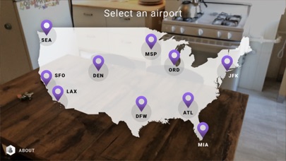
Flight Paths uses Augmented Reality to visualize the airspace above Americas busiest airports. Select an airport from the map, point your camera at a table or floor, and tap the screen to get started. A beautiful animation of flights taking off and landing will fill the sky above the airport. Flight Paths lets you see these 3D routes in a whole new way, right from your living room.


